Voisey's West Project
The Voisey's West Project is located 50 kilometres northwest of Voisey’s Bay Ni-Cu-Co (nickel-copper-cobalt) mine and 70km west of the town of Nain, in Newfoundland and Labrador, Canada. The Property is located in the Churchill Province of Labrador and consists predominately of quartz-feldspathic and metasedimentary gneisses derived from plutonic and sedimentary rocks. The rocks are intruded by the multi-phase, Nain Plutonic Suite (NPS) composed primarily of anorthosite, troctolite, diorite and granitoids.
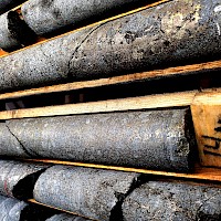
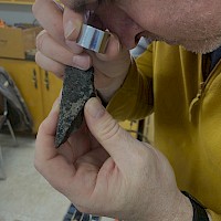
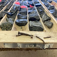
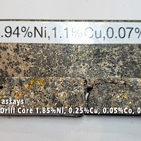
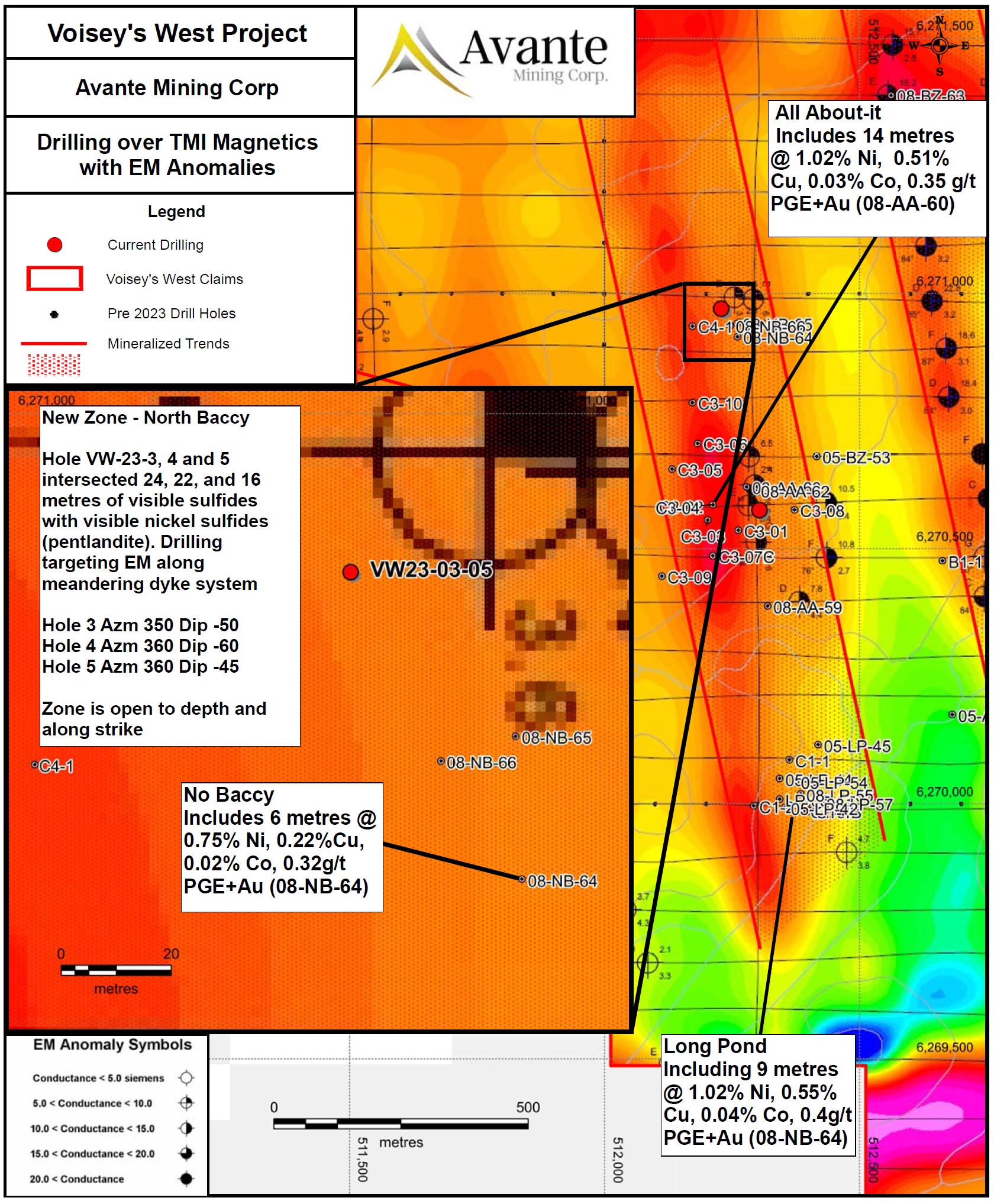
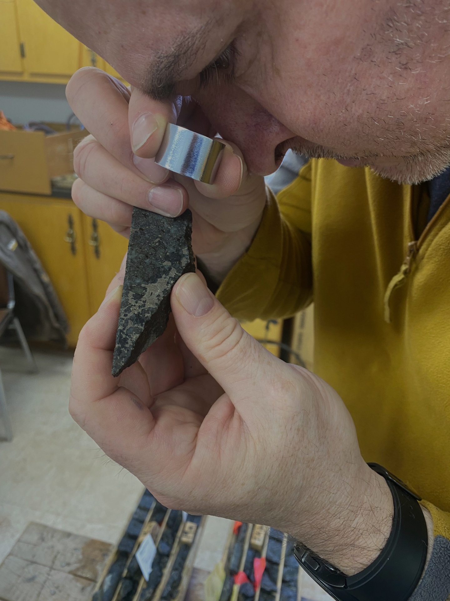
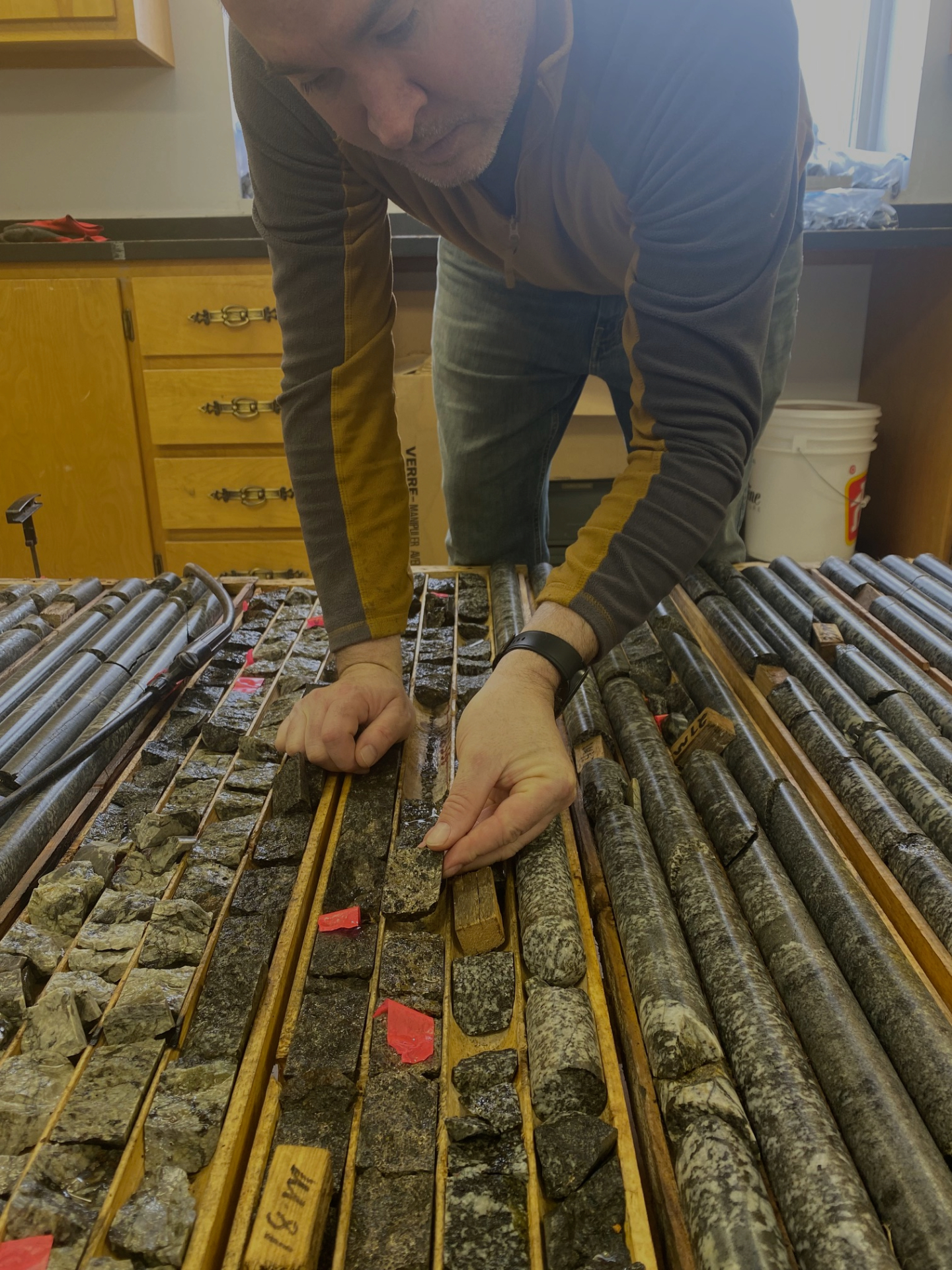
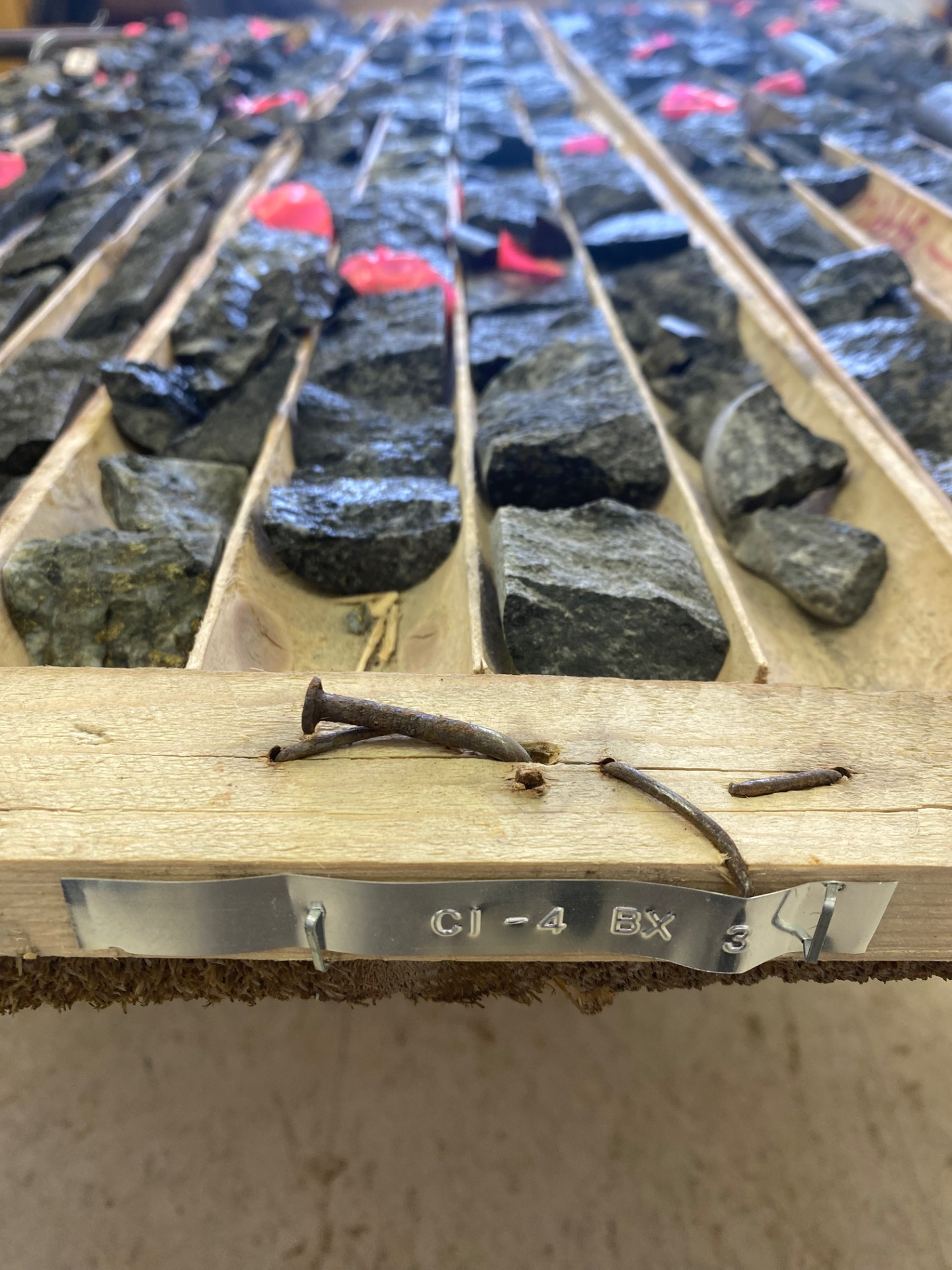
Following the discovery of Voisey’s Bay deposit, enhanced regional prospecting led to the discovery of three pyrrhotite-chalcopyrite-pyrite showings located on the Property, namely, the Long Pond, All About-it, and No Baccy. Initial surface grab samples from the Long Pond and All About-it Showings returned up to 1.36% Ni and 0.58% Cu, and 1.05% Ni and 1.53% Cu respectively. Initial chip sampling at the No Baccy Showing returned up to 0.71% Ni and 0.85% Cu over 2.3 metres (Saunders & Scott, 2003). Work continued on the Property through 1995-1996 and 2001-2008 which resulted in the identification of a primary mineralized corridor occurring over approximately 2 kilometres centered on the Property. Below are selected highlights from the drilling on the Property.
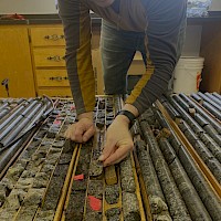
2023 Drilling Program
Voisey’s West - 2023 Exploration Drilling
| from (m) |
to (m) |
Int. (m) |
Ni (%) |
Cu (%) |
Co (%) |
Au (g/t) |
Pt (g/t) |
Pd (g/t) |
PGE+ Au (g/t) |
NiEq (%)* |
|
|---|---|---|---|---|---|---|---|---|---|---|---|
| VW23-03 | 1.26 | 24.00 | 22.74 | 0.62 | 0.16 | 0.02 | 0.06 | 0.02 | 0.12 | 0.21 | 0.78 |
| incl. | 1.26 | 4.00 | 2.74 | 1.45 | 0.23 | 0.04 | 0.04 | 0.00 | 0.25 | 0.30 | 1.68 |
| and incl. | 16.00 | 18.00 | 2.00 | 1.23 | 0.22 | 0.03 | 0.06 | 0.03 | 0.27 | 0.37 | 1.46 |
| and incl. | 23.00 | 24.00 | 1.00 | 1.21 | 0.15 | 0.03 | 0.03 | 0.00 | 0.17 | 0.20 | 1.37 |
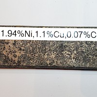
Individual samples up to 1.90 % Nickel, 0.05 % Cobalt, 0.43 g/t Gold, and 0.35 g/t Palladium over 1m
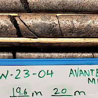
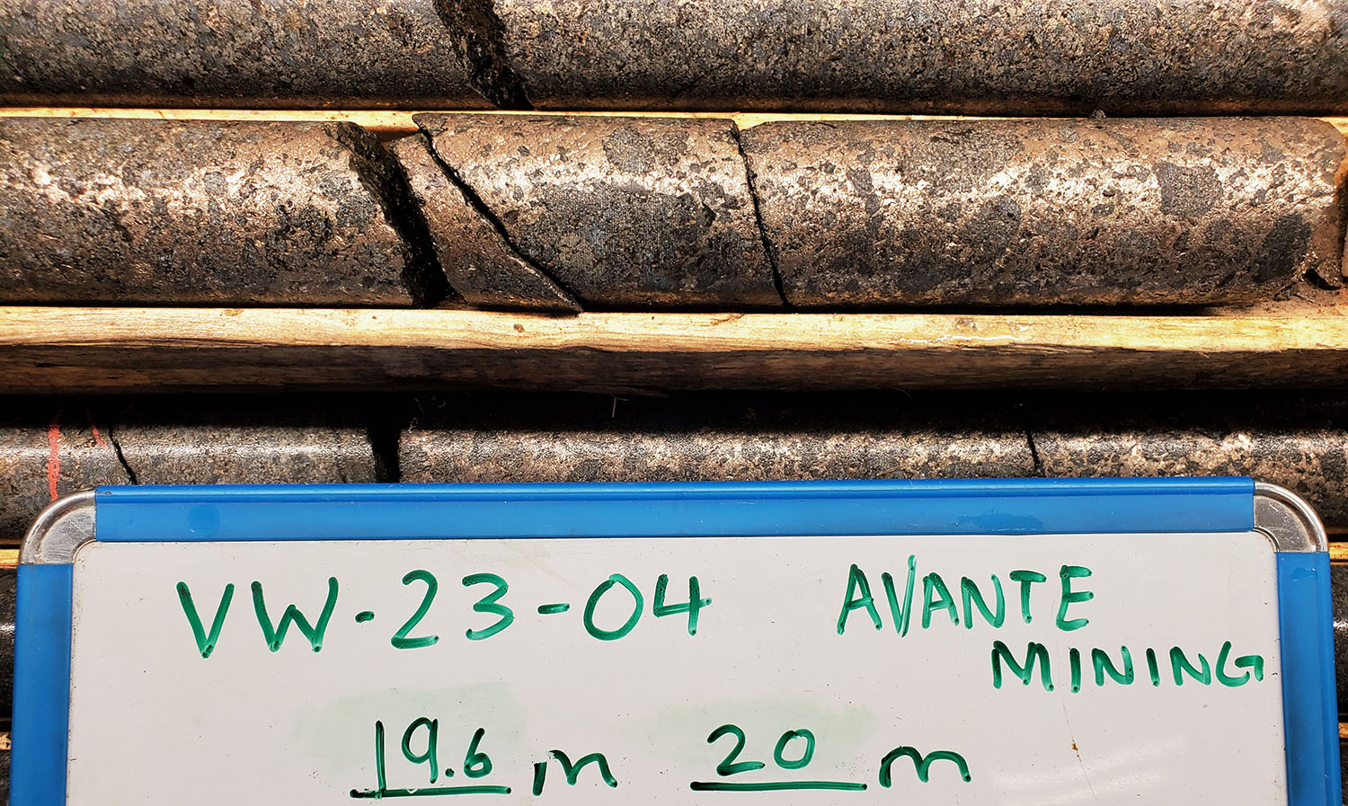
| VW-23-04 | From (m) |
To (m) |
Int (m) |
Ni (%) |
Cu (%) |
Co (%) |
Au (g/t) |
Pt (g/t) |
Pd (g/t) |
PEG + Au (g/t) |
NiEq (%) |
|---|---|---|---|---|---|---|---|---|---|---|---|
| 3.9 | 22.0 | 18.1 | 0.75 | 0.31 | 0.02 | 0.04 | 0.03 | 0.18 | 0.25 | 0.99 | |
| incl. | 3.9 | 7.0 | 3.1 | 0.79 | 0.25 | 0.02 | 0.06 | 0.16 | 0.16 | 0.38 | 1.03 |
| and incl. | 13.0 | 22.0 | 9.0 | 1.12 | 0.33 | 0.03 | 0.03 | 0.01 | 0.28 | 0.31 | 1.39 |
| incl. | 13.0 | 14.0 | 1.0 | 2.84 | 0.20 | 0.08 | 0.02 | 0.01 | 0.91 | 0.94 | 3.28 |
| incl. | 19.0 | 22.0 | 3.0 | 1.61 | 0.48 | 0.05 | 0.03 | 0.00 | 0.29 | 0.33 | 1.98 |
Individual samples up to 2.84 % Nickel, 0.75% Copper, 0.08 % Cobalt, and 0.49 g/t Palladium over 1m
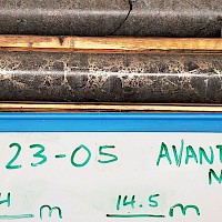
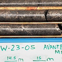
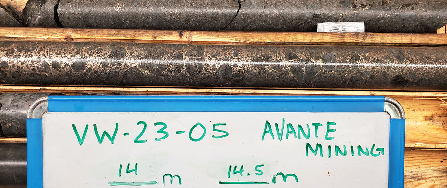
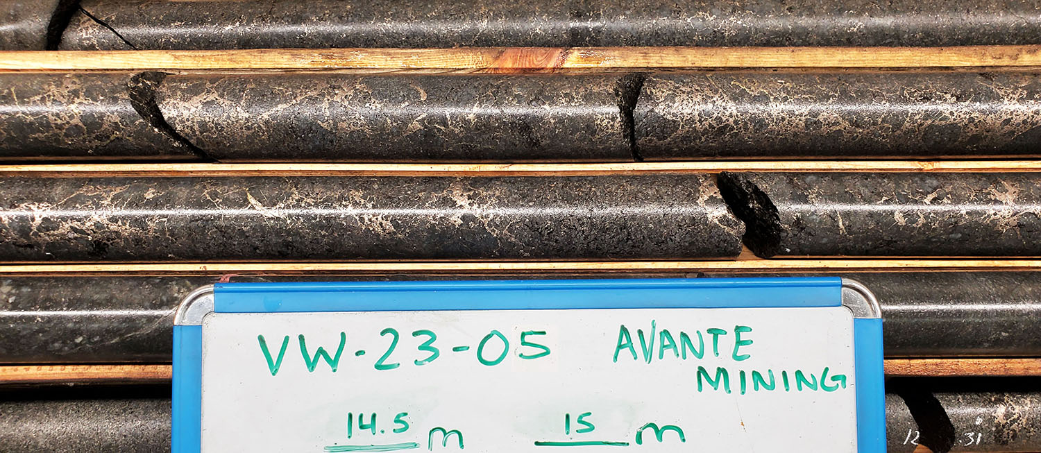
| VW-23-05 | From (m) |
To (m) |
Int (m) |
Ni (%) |
Cu (%) |
Co (%) |
Au (g/t) |
Pt (g/t) |
Pd (g/t) |
PEG + Au (g/t) |
NiEq (%) |
|---|---|---|---|---|---|---|---|---|---|---|---|
| 1.2 | 16.0 | 14.8 | 0.61 | 0.37 | 0.02 | 0.08 | 0.02 | 0.12 | 0.22 | 0.86 | |
| incl. | 1.2 | 3.0 | 1.8 | 0.89 | 0.29 | 0.02 | 0.03 | 0.01 | 0.20 | 0.24 | 1.12 |
| and incl. | 12.0 | 15.0 | 3.0 | 1.20 | 0.94 | 0.03 | 0.13 | 0.03 | 0.16 | 0.32 | 1.75 |
Individual samples up to 1.45 % Nickel, 1.55% Copper, 0.04 % Cobalt, and 0.28 g/t Gold over 1m
*Nickel Equivalents were calculated based on 8.23$/lb Nickel, 3.58$/lb Copper, 15$/lb Cobalt, 1970$/oz Gold, 894$/oz Platinum, 1110$/oz Palladium, and recoveries calculated at 100%.
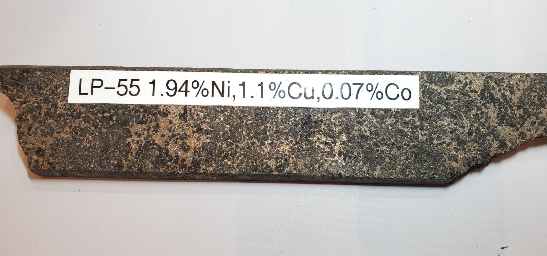
Select Historic Drilling Highlights
| Zone | Hole ID | From (m) |
To (m) |
Interval (m) |
Nickel (%) |
Copper (%) |
Cobalt (%) |
Au + PGE (g/t) |
|---|---|---|---|---|---|---|---|---|
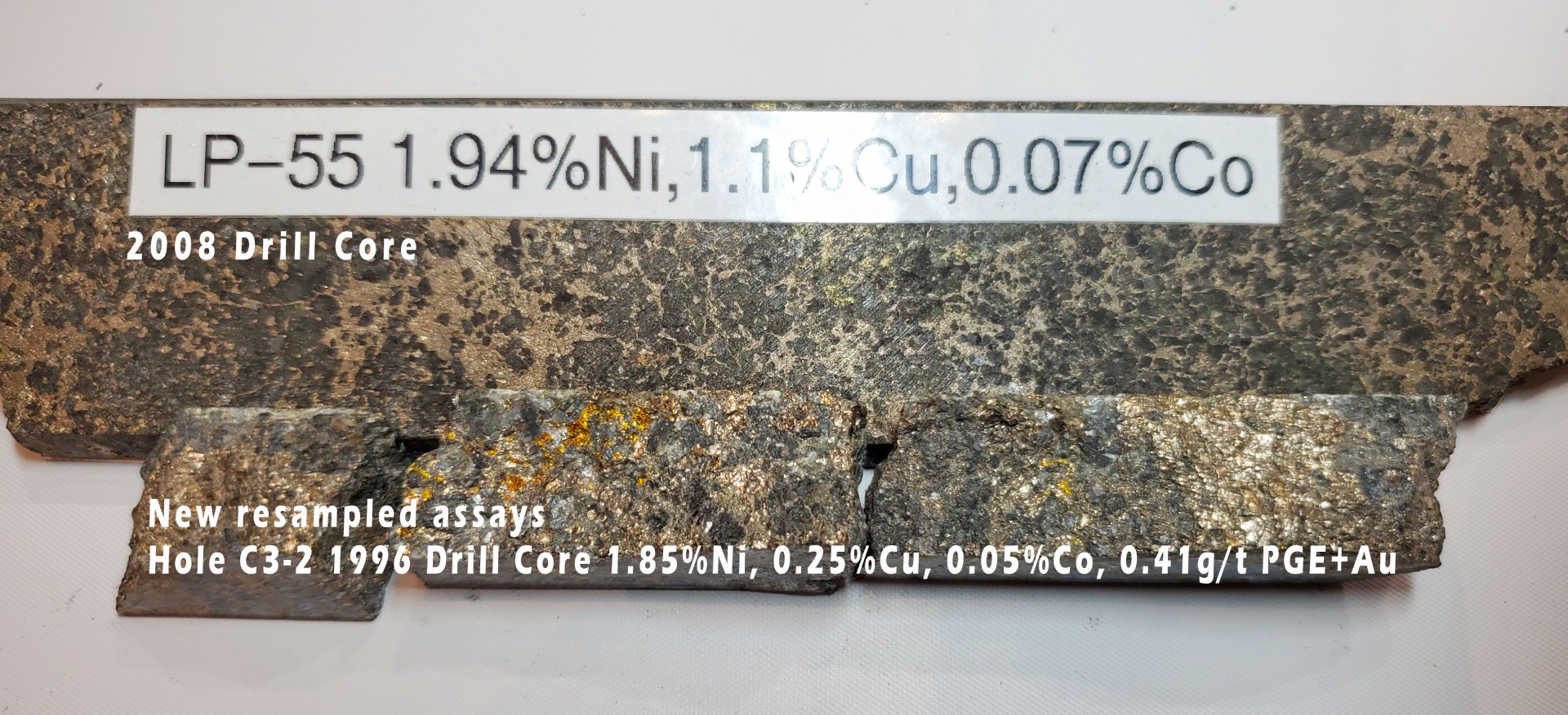
| Long Pond | 08-LP-55 | 7 | 21 | 14 | 0.80 | 0.85 | 0.03 | 0.36 |
| including | 10 | 19 | 9 | 1.02 | 0.55 | 0.04 | 0.40 | |
| including | 7 | 13 | 6 | 1.02 | 1.59 | 0.05 | 0.30 | |
| Long Pond | 08-LP-56 | 8 | 25 | 17 | 0.41 | 0.15 | 0.02 | 0.16 |
| including | 8 | 14 | 6 | 0.69 | 0.24 | 0.02 | 0.21 | |
| including | 9 | 12 | 3 | 1.04 | 0.38 | 0.03 | 0.28 | |
| All About-it | 08-AA-60 | 3 | 42 | 39 | 0.57 | 0.28 | 0.02 | 0.25 |
| including | 6 | 20 | 14 | 1.02 | 0.51 | 0.03 | 0.35 | |
| WITH | 13 | 14 | 1 | 2.15 | 0.38 | 0.05 | 0.36 | |
| All About-it | 08-AA-61 | 2 | 31 | 29 | 0.42 | 0.21 | 0.02 | 0.15 |
| including | 5 | 6 | 1 | 1.62 | 0.66 | 0.05 | 0.35 | |
| including | 8 | 10 | 2 | 1.23 | 0.34 | 0.04 | 0.41 | |
| All About-it | 08-AA-62 | 5.5 | 41.5 | 36 | 0.42 | 0.19 | 0.02 | 0.19 |
| including | 7.5 | 10.5 | 3 | 1.01 | 0.39 | 0.04 | 0.63 | |
| including | 11.5 | 13.5 | 2 | 1.09 | 0.25 | 0.06 | 0.53 | |
| No Baccy | 08-NB-64 | 5.50 | 11.5 | 6 | 0.75 | 0.22 | 0.02 | 0.32 |
| including | 5.50 | 7.5 | 2 | 1.47 | 0.28 | 0.03 | 0.46 | |
| Long Pond | 05-54 | 5.5 | 13.8 | 8.30 | 0.84 | 0.37 | 0.02 | Not Assayed |
| including | 6.8 | 11.8 | 5.00 | 1.19 | 0.53 | 0.03 | Not Assayed | |
| Long Pond | C1-2 | 19.98 | 23.7 | 3.72 | 0.72 | 0.38 | 0.02 | Not Assayed |
| All About-it | C3-2 | 13.3 | 37 | 23.7 | 0.47 | 0.16 | 0.02 | Not Assayed |
| including | 16 | 21.23 | 5.23 | 1.15 | 0.42 | 0.04 | Not Assayed |
*PGE+Au is non-weighted combined values of platinum + palladium + gold measured in grams per tonne.
**Source: Newfoundland and Labrador GeoFile Numbers: 014D/10/0313, 014D/10/0302, 014D/10/0229.
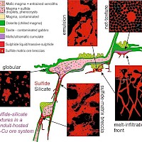
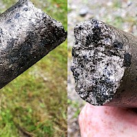
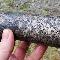
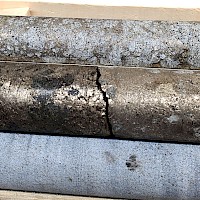
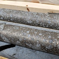
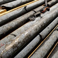
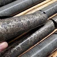
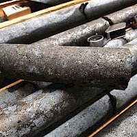
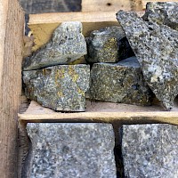
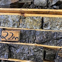
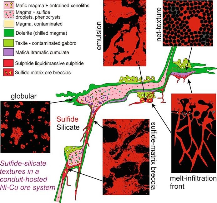
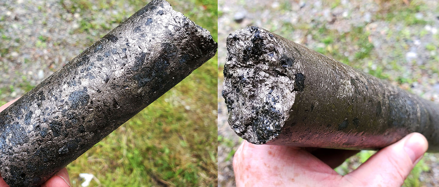
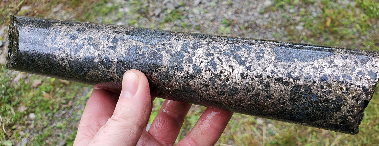
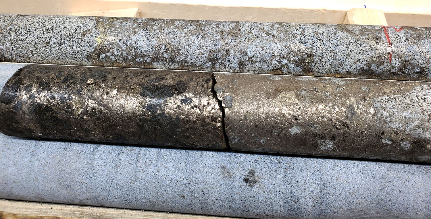
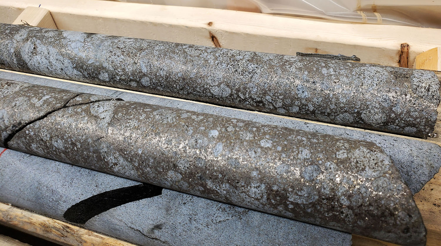
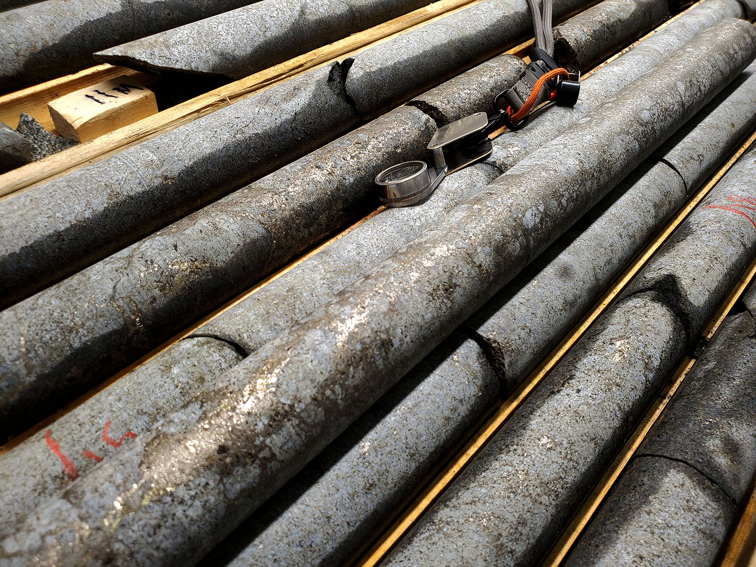
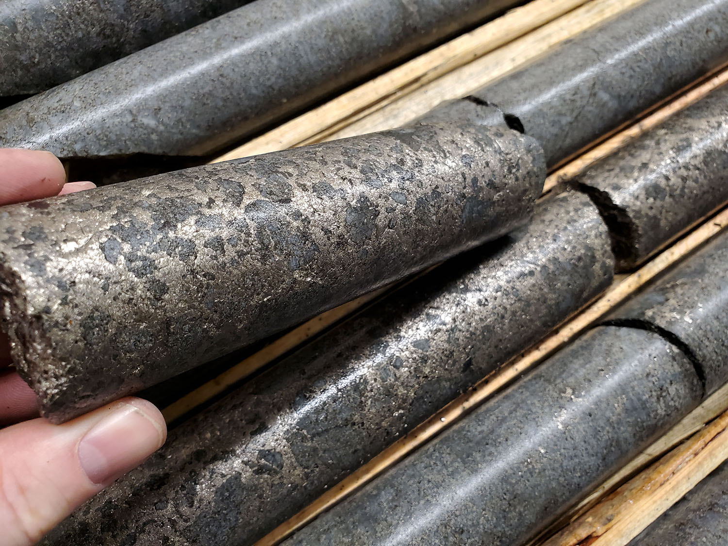
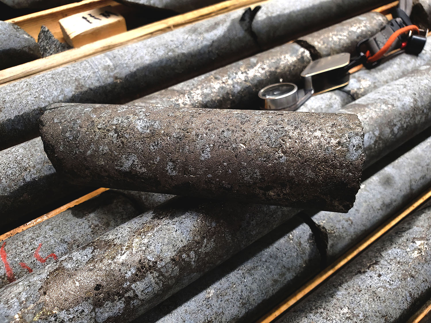
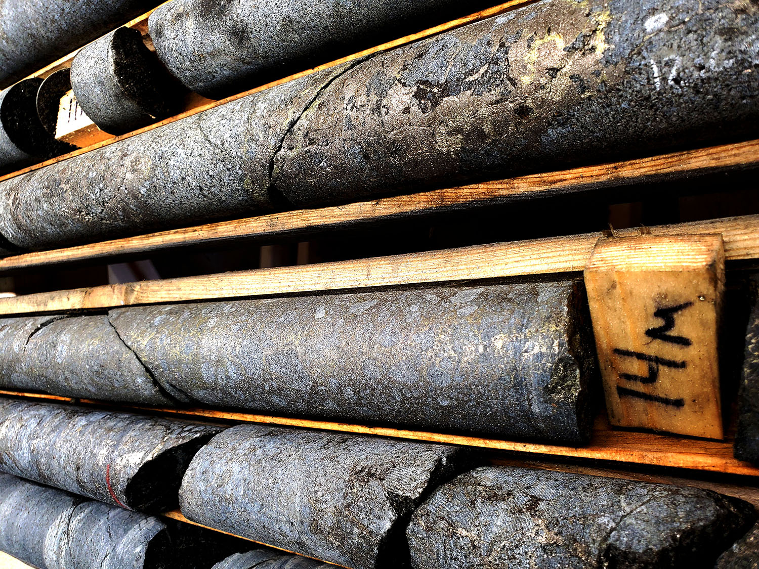
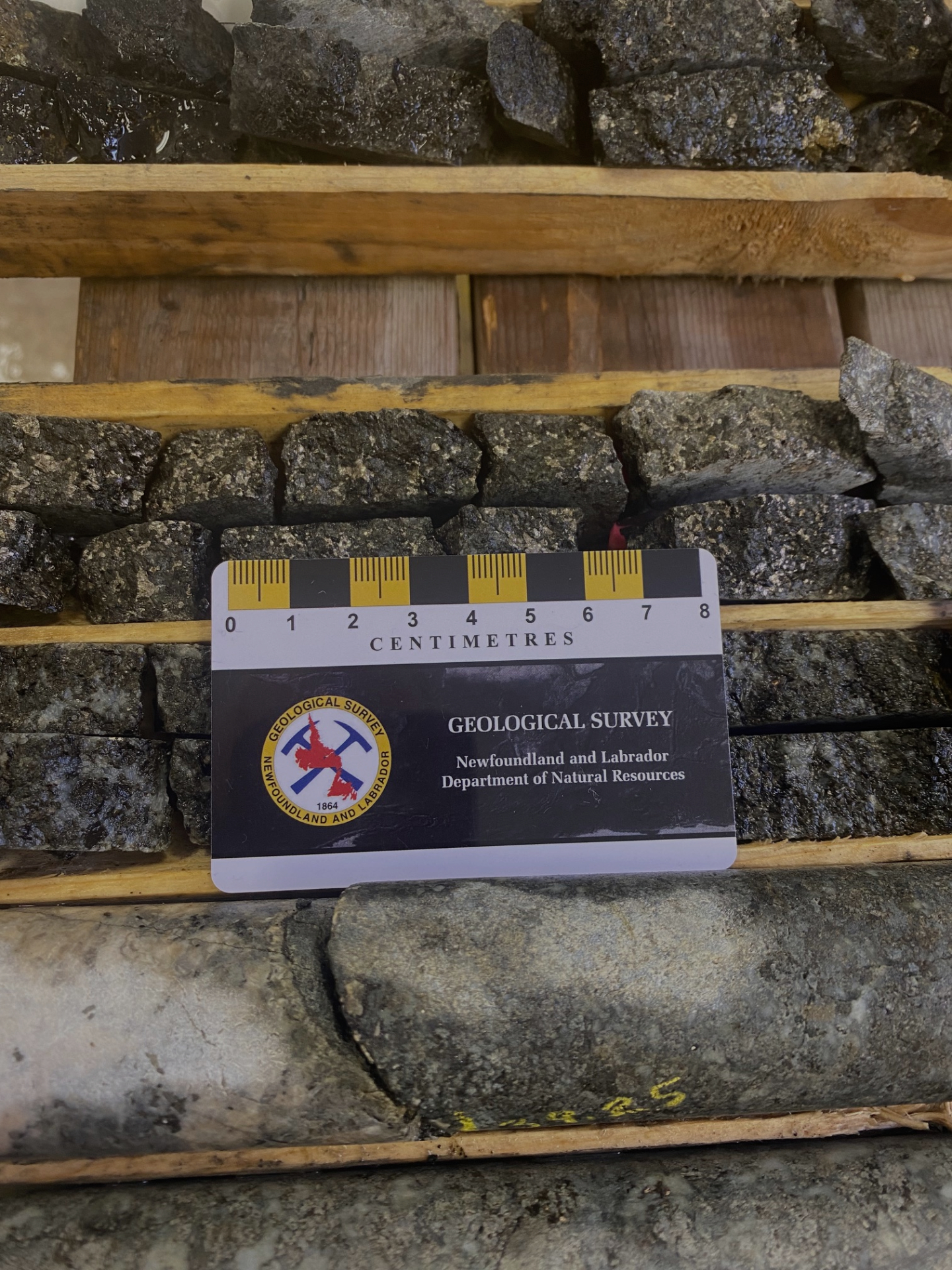
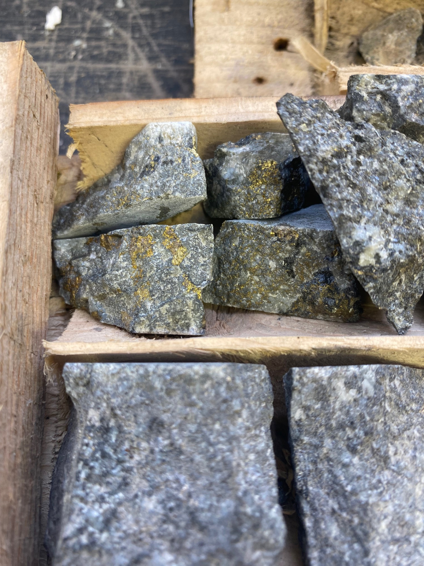
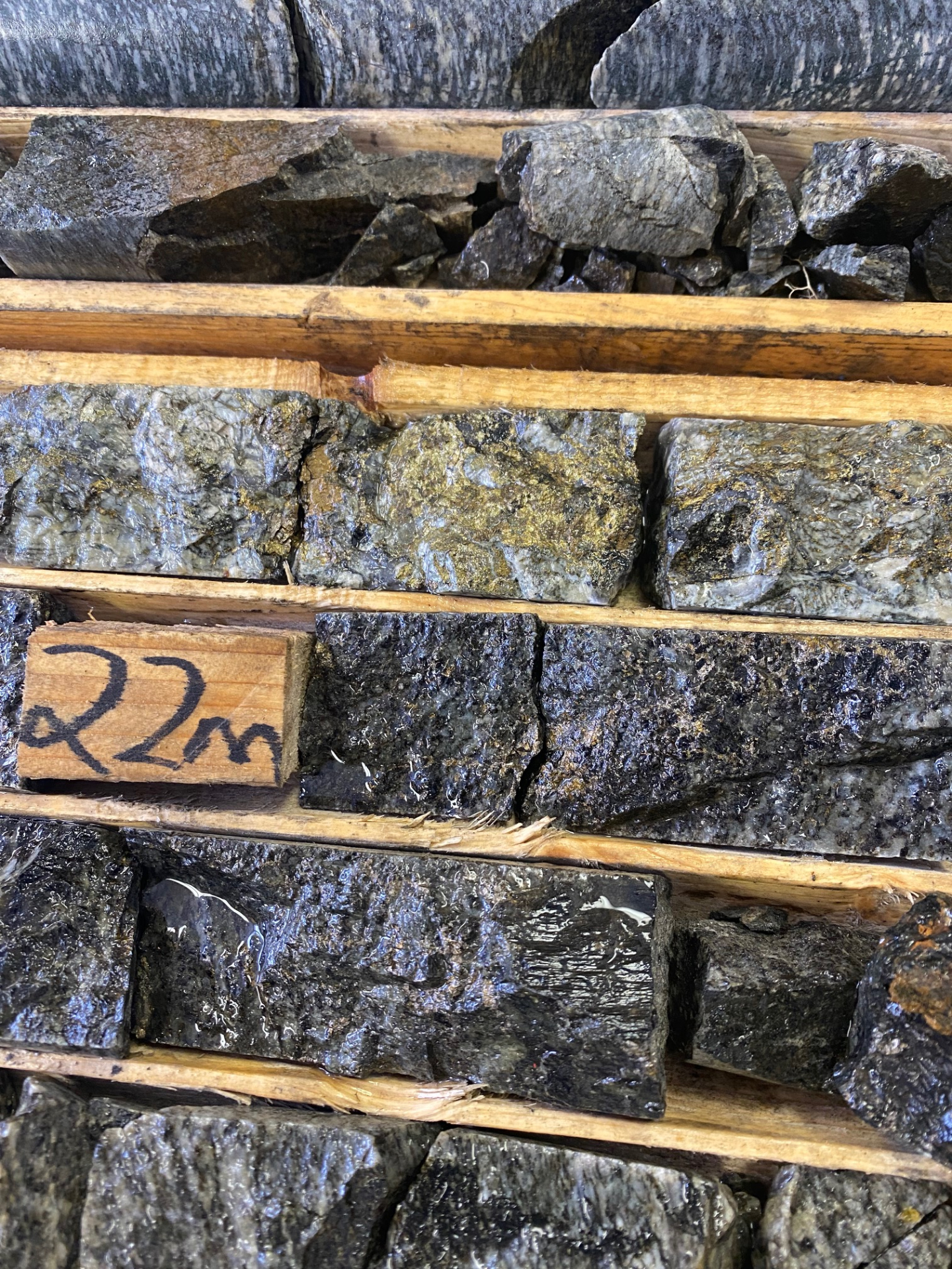
Previous drilling did not test the structures to depth, as such the mineralization remains open. The mineralization is contained within troctolitic gabbroic intrusive rocks and consists of pyrrhotite, pentlandite and chalcopyrite, up to 40% sulphide content has been observed locally, and exhibits leopard textures typical of mineralization at the Voisey’s Bay orebody.
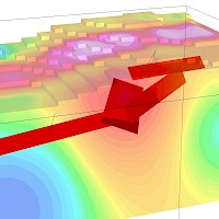
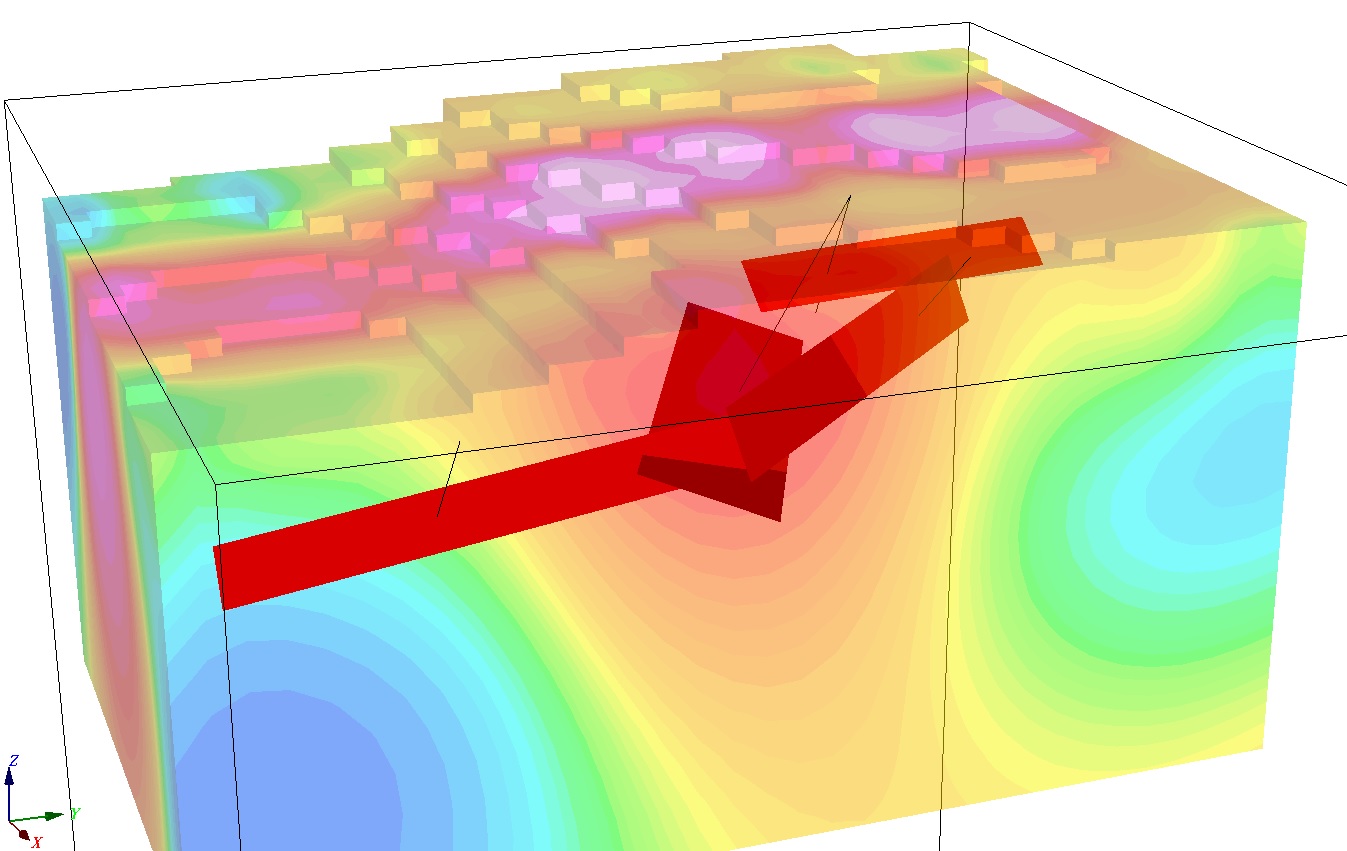
An Airborne VTEM/MAG survey completed in 2008 outlined numerous EM conductors and coincident Magnetic anomalies giving better definition to current targets and identifying new ones which have not all been tested. It also has shown that the two mineralized trends (see Figure 1 below) can be traced for several km and leaving several high priority targets untested. The Company is in the process of completing a detailed data review and geological modeling program which will aid in planning future work programs on the Property.
Adrian Smith, P.Geo., is a QP as defined by National Instrument 43-101 for the above-mentioned project. The QP is a member in good standing of the Professional Engineers and Geoscientists Newfoundland and Labrador (PEGNL) and is a registered Professional Geoscientist (P.Geo.). Mr. Smith has reviewed and approved the technical information disclosed above.